
While the summer Nevera is a sudden, often violent, short-lived convective weather phenomenon, the Bora and the Jugo are two of the structural pillars of Croatian weather. They are the two core wind systems of the region—opposing forces that dictate where you can sail, where you should seek shelter, and how the sea will behave.
Understanding the nuances of these winds is essential for comfortable coastal cruising in the Adriatic. Here is a practical guide to reading, handling, and working with the Bora and Jugo when sailing in Croatia.
1. The Bora (Bura): The Cold Katabatic Force
The Bora (locally known as the Bura) is a north-to-northeastern wind. It is a katabatic* system, driven by pressure differences between a cold air mass over inland Europe (such as Maribor) and the warmer air over the Adriatic Sea.
It functions on the same meteorological principles as the Alpine Föhn or the French Mistral. Cold, dense air accumulates on the landward side of the coastal mountain ranges, such as the Velabit and Biokovo ridges. Once it spills over the mountains, it accelerates down the steep slopes, dropping onto the sea surface with significant velocity.
*A katabatic wind is a gravity-driven air flow where cold, dense air falls (also known as a Fall wind) rapidly down steep elevated terrain toward lower, warmer ground.
Our Experience: Looking Beyond the Black-and-White Warning
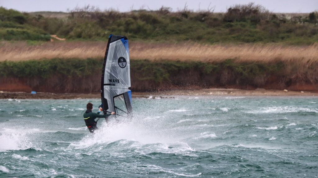
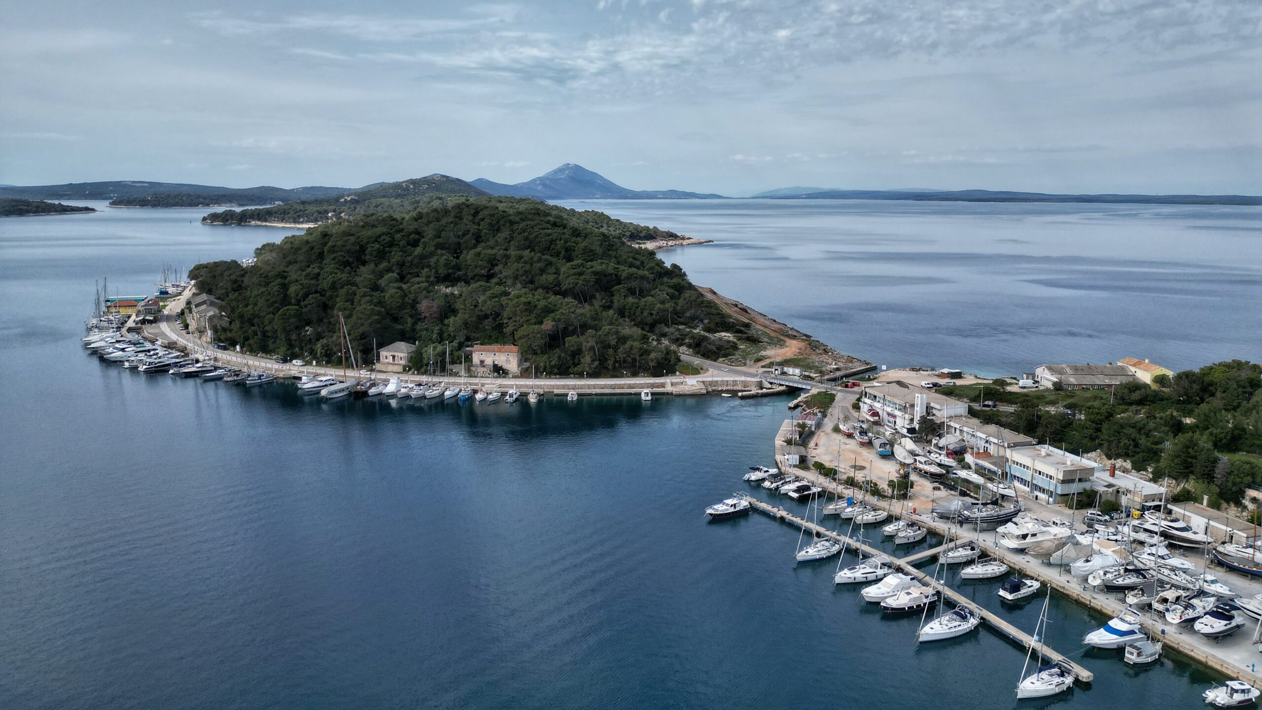
When we first chartered in Croatia, well-meaning but overly anxious friends passed their own concerns onto us, stripped of real-world context or local options. For them, weather risk was viewed in black and white: “The Bora is dangerous; if it is forecast, you simply do not leave the marina.” As new arrival skippers in the region, this projected anxiety made us overly cautious, and we unnecessarily missed out on several good sailing days. On that trip, with a Bora warning active, we chose to tuck ourselves into a marina in Mali Lošinj to sit it out, having noticed on the charts that the local wind gradient should be moderate there.
We had two completely pleasant, relaxing days on the island, but as we observed the weather unfold, we realised we could have safely been on the water. While the Bora was blowing hard through the Velabit and Kvarner channels, our pocket of the islands remained entirely manageable.
We subsequently learned that Boras vary significantly in intensity. Some are severe gales with gusts reaching 80 knots, while others simply offer excellent, clear-sky sailing conditions provided you understand the topography and find shelter from the winds descending off the mountains. Over the years, we have experienced both ends of the scale: we have happily sailed and anchored through moderate Bora, and we have spent nights with a steady 40 knots recorded inside a “sheltered” marina.
Real World Lessons
The true spectrum of the Bora is often best observed by watching how different crews cope with it. We once watched a charter boat struggle into a marina during a blow with their in-mast furling mainsail completely exposed and lashed clumsily to the mast and boom with spare lines. The crew had been caught out in severe conditions and, possibly due to a mix of high wind load and improper sail angle (we don’t know for sure), the furling mechanism jammed. Unable to roll the sail away, they were forced to manually douse and tie down the sail while underway just to reduce their windage enough to enter the harbour. It was a stark reminder of how quickly a minor mechanical complication can escalate when the environment changes. The extra windage definitely didn’t make their harbour manoeuvre any easier.
Read the Warnings
Because the Bora can be highly localised, we rely on a combination of digital forecasting models and immediate sensory observation rather than automated app icons.
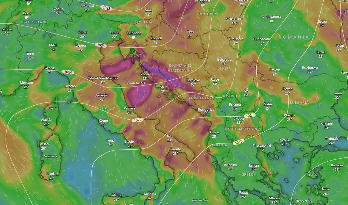
- The Windy Overlay: When evaluating weather models, a genuine Bora shows a highly distinct pattern. Look for an aligned Northeast/East orientation running along the entire length of the high coastal mountain ranges, with the wind on the immediate seaward side of the mountains looking recognisably stronger than in the surrounding sectors.
- The Gusts Layer: To find potential relief or assess the true operational threat, do not just look at the base wind layer. Switch to the Gusts layer on Windy; this is where the specific intensity and potential pockets of lighter wind become visible.
- The Temperature Drop: At the helm, your first physical warning is often thermal. You will notice a distinct, sharp drop in air temperature; the air suddenly feels cooler and crisper on your skin before the first heavy gusts arrive.
- Cloud Cap: Locals talk about a cloud cap on the coastal mountains such as the Velabit mountains. This cap signifies the start of the Bora, and when it’s at its peak, they tend to fracture a little. Once the clouds disappear, the Bora should be coming to an end. (With a Black Bora (see below), the clouds will come out over the sea bringing poor weather with them.)
- Model Consensus and Comparison: Local Croatian gale warnings can be notorious for over-triggering. Rather than relying on a single warning broadcast, use Windy’s built-in ‘Compare’ tool to view multiple forecasts side-by-side. For premium users, this includes the high-resolution local ALADIN model right alongside major global systems like ECMWF and ICON. When both the localised regional model and the global models align to show a unified wind event, you can trust that it is highly likely to materialise. If the models clash, it signals high uncertainty—meaning you should plan your itinerary around the worst-case scenario.
White Bora vs. Black Bora
- The White Bora (Most Common): This is the anticyclonic wind that occurs under clear blue skies. It brings crisp, cold, and exceptionally dry air. The visibility becomes remarkably sharp, making distant islands appear much closer than they are.
- The Black Bora (The Exception): This occurs when a low-pressure system sits over the southern Adriatic. It brings low clouds, persistent rain, and cold, sustained gales. While more common in winter, it can occasionally disrupt the shoulder seasons.
Another unnerving situation we witnessed involved a vessel coming back into port with its Genoa torn to ribbons, a stanchion bent flat, and the radar dome ripped clean off the mast. They had been caught out in a building Bora, and a minor complication while trying to furl the sail instantly spiralled into a massive chain reaction. In >30-knot gusts, the flailing jib sheets began whipping violently across the deck, wrapping around the radar dome and stanchion and tearing them out before the sail cloth disintegrated. It’s a heartbreaking experience, and a sobering reminder of just how fast a situation can get out of hand at sea when the environment escalates.
This is exactly why rigid, black-and-white ‘if-then’ rules fail in seamanship. Forcing a vessel using mechanical power rather than understanding the subtle variations of wind angle, load release, and line management will inevitably lead to structural failure.
The Bora Wave Profile: Short, Sharp Chop
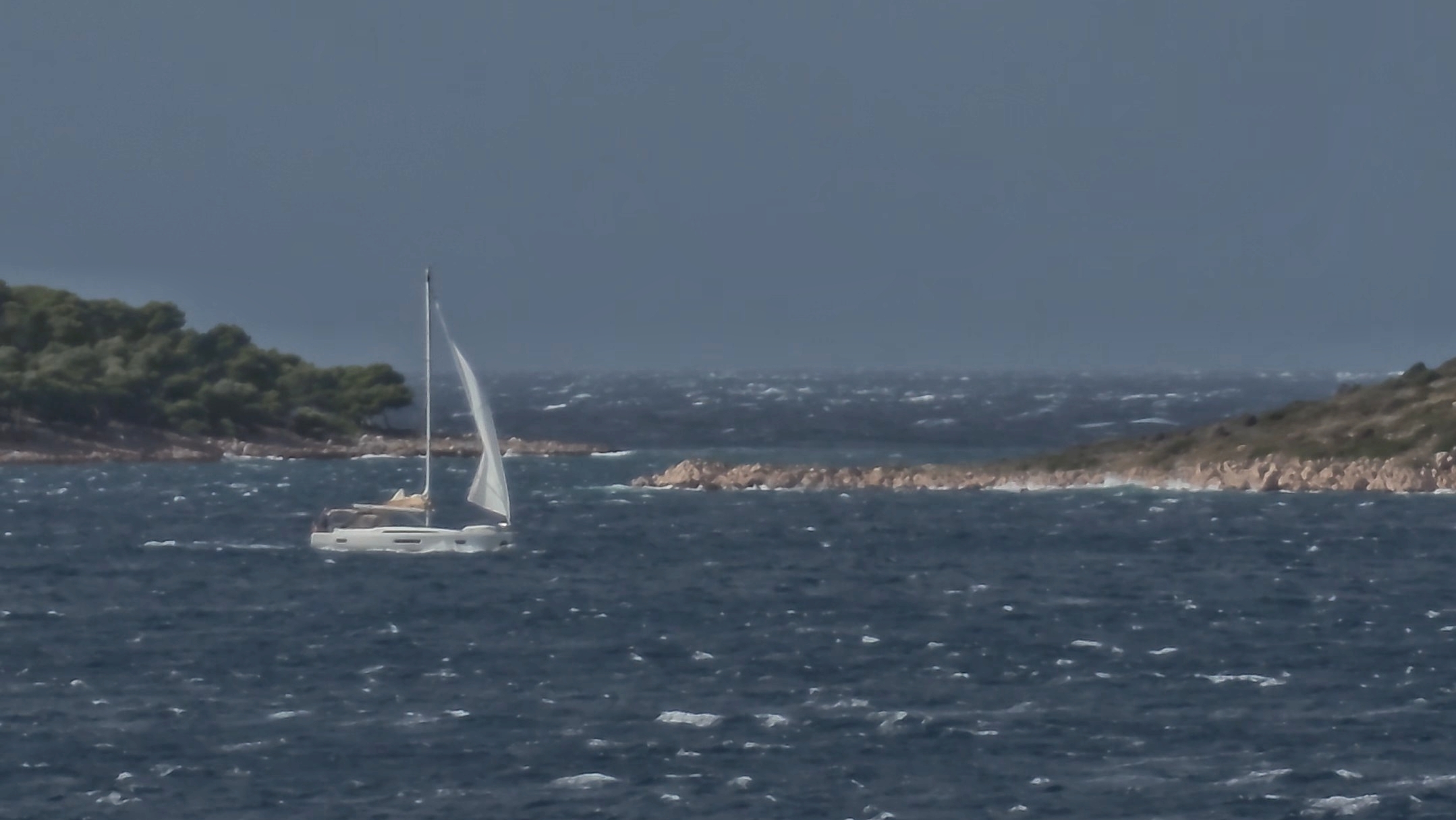
Because the Bora blows directly off the mainland mountains, it has very little “fetch” (the distance wind travels over open water to build a wave). Consequently, the sea right along the mainland coast remains deceptively flat, though the wind can atomise the surface into a white sea mist (with winds >45 knots) often seen in the Kvarner and Velabit channels.
As you move further offshore, the water develops into a disorganised, short, and sharp vertical chop. It is an erratic, steep sea state with a much shorter period than open-ocean waves, meaning it pounds a hull rather than lifting it.
Tactical Routing and Ground Tackle
- False Security of a Steep Coast: A frequent error is anchoring right at the base of a steep mainland mountain, assuming the high terrain will block the wind. The katabatic effect actually accelerates as it drops. If you anchor directly under the cliffs, heavy gusts can descend vertically onto your deck overnight without warning. It is far safer to identify lighter areas on the Windy gusts layer and seek shelter in the lee of the lower, outlying islands (such as Mali Lošinj or Korčula), where the high terrain of intervening land shifts the main force over your mast. With katabatic winds, the actual wind felt at the water surface may be stronger than what your masthead instruments measure!
- The Illusion of the Bay: Topography can play tricks on your situational awareness. We once spent a perfectly calm, beautifully sheltered night at anchor in Uvala Žuljana on the Pelješac peninsula. In the morning, the bay was still flat and peaceful. We raised the mainsail while still at anchor in nice, light conditions, but because we knew what the models looked like outside, we proactively put a double reef in the sail. It was the correct decision: the moment our bow cleared the natural wind shadow of the bay’s headland, we were instantly slammed by a 30-knot gust out of nowhere.
- Balanced Snubber: Because the Bora is inherently gusty, a boat at anchor will often yaw violently from side to side, placing immense, snapping loads on your windlass. Always deploy a snubber line to take the load off the windlass brake, but ensure your setup is highly practical. First, keep it simple and easy to release in case you need to abandon the anchorage quickly. Second, avoid fixing the snubber to just a single bow cleat on one side of the hull. Doing so pulls the boat off-centre, causing it to sheer heavily and increasing the violent sailing action. Instead, rig a balanced Y-bridle or lead the line cleanly through the centre bow roller. This allows the boat to seek head-to-wind naturally and stabilises your position. It will still sail a little at anchor, but the loads will tend to be more balanced in the long run.
2. The Jugo (Scirocco): The Humid Wave-Builder
The Jugo (known across the wider Mediterranean as the Scirocco) is a stable, large-scale gradient wind that blows from the south-southeast. It is triggered by a low-pressure cyclone moving to the west of the Adriatic, drawing air directly up from North Africa.
The Weather Profile: Warm, Humid, and Progressive
While the Bora is cold and clear, the Jugo is warm, intensely humid, and heavy. It brings a falling barometer, low cloud decks, and steady rain. Because the air mass originates in the Sahara, a sustained Jugo often carries fine desert dust, leaving a distinct orange film across the decks. (Keep your sails in their sail bags if you want to keep them white!)
Spring and Autumn Jugo Storms: High Winds and Steep Seas
During the spring and autumn shoulder seasons, the Jugo can develop into substantial, long-lasting storms. We have experienced Jugo conditions delivering sustained winds of 40 to 50 knots. While these high-intensity conditions can be excellent for windsurfing or wing-foiling, they are far from ideal for comfortable cruising under sail.
At this high intensity, the waves can easily build to heights of 3 or 4 metres. However, because the Adriatic is a relatively narrow, enclosed basin, these waves still retain a short wave period. They are steep, close together, and aggressive. Even in a moderate Jugo, the short-period swell bouncing inside the island channels can quickly cause severe motion sickness for an unprepared crew.
Tactical Routing: Working Inside the Channels
Because the Jugo builds gradually over 24 to 48 hours as the barometric pressure drops, it allows plenty of time for route planning.
While the open sea outside the archipelago becomes rough, a skipper can move into the protected inner island channels. Using the outer islands as a natural breakwater blocks the open-sea waves. While it will still be windy, the water inside the channels remains relatively flat, allowing for predictable downwind or reaching sails.
It is simply a matter of identifying shelter on the northwestern or northeastern bays of the islands early, as open southern bays become completely untenable as the swell rolls in. Always account for acceleration zones—narrow channels and geographical gaps where the wind speeds compress and can suddenly intensify around the islands.
Good seamanship is never about rigid rules; it is about objective risk analysis. When evaluating a Bora or Jugo forecast, apply the three core pillars of our Go/No-Go Decision Tool available on our app to evaluate if your planned route is a calculated success or an unnecessary gamble.
1. The Human Factor (Who is on board?)
The Skipper: A moderate Bora or a rolling 25-knot Jugo offers exceptional downwind training for an Intermediate or Veteran skipper. However, if you are a Rookie skipper (<5 charters), the erratic nature of katabatic mountain gusts can quickly exhaust your capacity.
The Crew: A Passive crew or family group will tolerate a clean, flat-water sail in the lee of the outlying islands during a White Bora. Conversely, the steep, short-period rolling swell of a Jugo will quickly render a passive crew incapacitated by severe motion sickness. If your crew is compromised, your overall safety margin shrinks instantly.
2. The Environment (What is the weather doing?)
Wind Alignment: Use Windy to track the development curve. A unified Northeast/East alignment along the mainland ridges signals a true Bora; a building Southeast gradient indicates a Jugo. Keep a close eye on acceleration zones where channels compress the wind.
Sea State: A Bora creates a short, sharp, disorganised vertical chop that pounds the hull. A Jugo builds a much larger, steep rolling swell. The Cutoff: If the forecast shows a spring or autumn Jugo storm exceeding 40 knots, creating a 3- to 4-metre short-period sea, it is strictly a Port/Marina day regardless of crew experience.
3. The Destination (Is it safe to stay there tonight?)
Bora Protection: Look for deep bays on the southern or southwestern sides of the islands (Offshore Wind / Protected), ensuring you stay well clear of steep mainland cliff drop-zones where the wind accelerates vertically.
Jugo Protection: Seek shelter in deep northeastern or northwestern bays early, or secure a berth in a modern marina. Avoid all southern-facing exposed bays, as the short-period swell will wrap around headlands and break anchor traction.
🚦 The Traffic Light Status
🟢 GREEN Status: Conditions are well within your team’s comfort zone. The wind is under 20 knots, the crew is active, and you are using inner island channels or outlying islands to mask open sea waves.
🟡 AMBER Status: Risks are present. Winds are pushing 25–30 knots, or you have a passive crew on board. You must shorten your day, identify a solid “Plan B” shelter early, and brief your crew on clear deck protocols.
🔴 RED Status: High risk. The environment shows a severe convective front, a full-scale 40+ knot Jugo storm, or unpredictable 50+ knot katabatic Bora blasts. The potential outcome is not worth the risk. Stay in port, secure your lines, and enjoy the local town quay.
If these decisions still worry you, you could consider joining one of our Bareboat in Company weeks.
Summary: The Adriatic Wind Contrast
| Metric | The Bora (Bura) | The Jugo (Scirocco) |
| Wind Direction | Northeast (NE) | South-Southeast (SSE) |
| Air Quality | Cold, crisp, exceptionally dry | Warm, heavily humid, oppressive |
| Atmosphere | High visibility (White) or Rain (Black) | Low clouds, overcast, Sahara sand dust |
| Wave Structure | Flat near coast ➔ Short, sharp, white chop | Large, steep, short-period rolling swell (Up to 3-4m in storms) |
| Sailing Strategy | Head further offshore / around outlying islands | Use inner island channels to minimise open waves |
| Anchoring Consideration | Do not anchor under steep mainland cliffs | Avoid all southern-facing exposed bays |
In Spring and Autumn you can expect to experience one or both of these systems on a typical one or two week period in the Adriatic. We have experienced two Boras and one Jugo once in a two-week trip in April. We still got some great sailing in between but had 3 days harbour bound over the two weeks due to winds in excess of 40 knots.
Explore the Elements with All Winds Adventures
Understanding local weather patterns is what transforms a coastal cruise into a rewarding experience. At All Winds Adventures, we focus on thorough preparation and practical seamanship.
- Charter All Winds Directly: Our Beneteau Oceanis 41.1 is available for bareboat charter bookings directly from our base in Croatia.
- Worldwide Charter Brokerage: Planning a holiday elsewhere in the Ionian, Adriatic, or Tyrrhenian seas? As an independent agency, we source and vet quality fleets worldwide to ensure your logistics run smoothly.
- Sailing & Windsurfing Coaching: Want to improve your heavy-weather sail trim, understand wind gradients, or handle short-period chops? We offer coaching clinics on the Swiss Lakes (Zug/Zurich) as well as practical milestone training weeks in the Mediterranean.
Local Dalmatian lore states that the Bora “goes to lunch” between roughly 12:00 and 14:00, softening slightly during the heat of midday. While this is not a strict scientific guarantee, it frequently holds true in summer conditions. For a skipper stuck in an uncomfortable anchorage or needing to change positions, this midday lull provides a brief, tactical window to slip your lines and move to a more secure location before the katabatic gusts reassert themselves in the late afternoon.
During the peak summer months (June to August), a Bora or Jugo episode is usually short-lived, typically blowing for only one or two days as a localised gradient shift. However, in the spring and autumn shoulder seasons, their behaviour shifts dramatically. A shoulder-season Jugo storm can blow consistently for three to five days, steadily building its wave heights, while a severe autumn Bora can lock the coast down for up to a week. Understanding this seasonal difference is vital for planning realistic itineraries on a standard week-long charter.
When routing through the Croatian archipelago, if you observe an island coastline that is completely stripped of trees and vegetation—such as the eastern side of Pag or parts of the northern Kvarner islands—you are looking at a permanent geological signature of the Bora. These bare, white-stone landscapes are carved by hurricane-force katabatic winds carrying dense salt spray off the mainland mountain passes, which systematically kills off any plant life. Seeing this is an immediate visual cue that the sector is a primary wind tunnel and should be entirely avoided for anchoring or overnight stays during a Bora forecast.
Look for a clear model consensus rather than relying on a single automated forecast track. Use Windy’s built-in ‘Compare’ feature to stack different weather models side-by-side. For premium users, this allows you to view the high-resolution regional ALADIN model directly alongside global systems like ECMWF and ICON. By analysing the hourly timeline across all these platforms simultaneously, you can check for general agreement. If both the local regional model and the global models show a unified Northeast/East alignment directly seaward of the high coastal mountain ranges, the forecast carries a very high probability of accuracy.
The Bora is a katabatic wind system, meaning the cold, dense air gains velocity as it cascades down steep topography. Anchoring right at the base of a high mountain range exposes your vessel to violent, vertical down-blasts that descend onto the sea surface without warning. It is much safer to look at the gusts layer and anchor further offshore or in the lee of the lower, outlying islands.
It depends entirely on the intensity spectrum. In a moderate Jugo (15–25 knots), an experienced crew can use the inner island channels as a natural breakwater to block open-sea waves, allowing for excellent downwind sails on relatively flat water. However, during spring and autumn Jugo storms where winds reach 40 to 50 knots, the short-period waves can easily reach 3 to 4 metres and begin wrapping around headlands, making it unsafe to sail even within the channels.

No responses yet